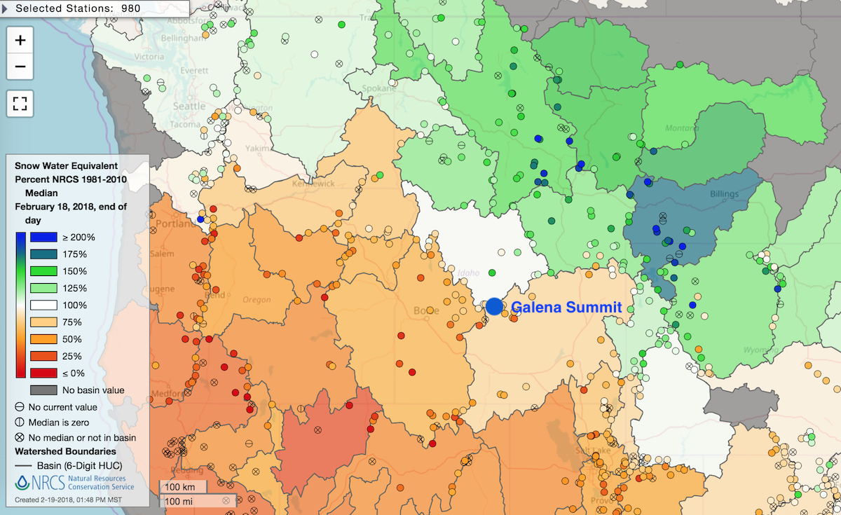
Snow water percent of average for the Western U.S. as of February 18, 2018. Green is above average, white is average, orange is below. Click to enlarge.
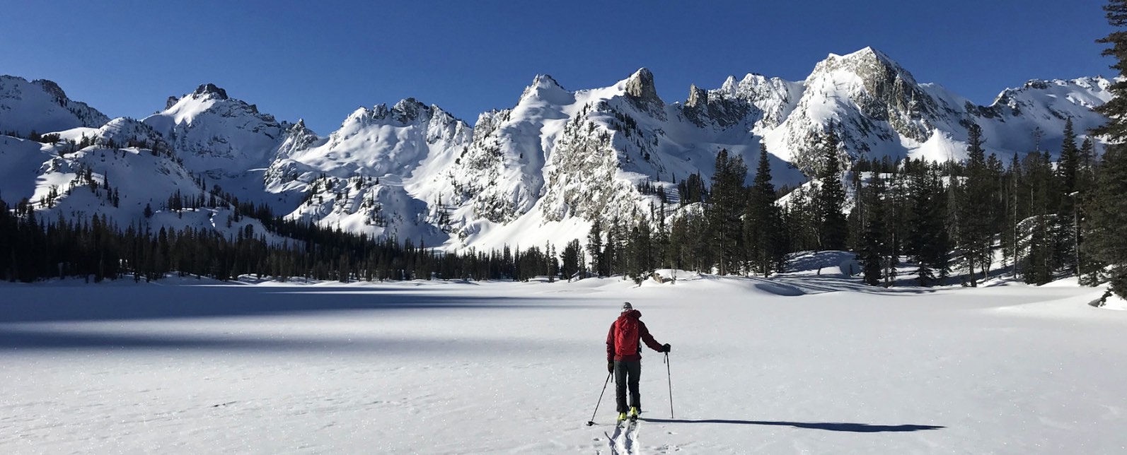
It’s been a feast or famine season in the western U.S. Looking at the map to the right, it’s clear that the northern mountain states are having a banner snow year, while the southwest is well below average. Turns out our area is about smack dab on the feast/famine boundary. It’s been a lean winter in the Wood River Valley, while in our operating area of Galena Summit, Sawtooths, and Banner Summit the snowpack is hovering around average. And given the drought conditions in a good portion of the West, we feel very grateful for average.
Much of the early winter was plagued with persistent slab instabilities and elevated avalanche hazard, but we continued to find good ski conditions on lower angled slopes. Windy and warm conditions in early February led to decreasing ski quality, but a stabilizing snowpack allowed us to finally nose into steeper terrain that hadn’t really been touched all winter. SMG guides took advantage of some rare time off after our hectic Level 1 season to get into the Sawtooth high country near the Williams Peak Hut, above Alice Lake, and even a one-night mission into the upper Hellroaring drainage.
Valentine’s Day brought a welcome return to winter as snow began to fall in the mountains. Since then, 12-18″ of powder has accumulated in the mountains from Galena Summit northward, and we’ve had better powder conditions than we’ve seen since in nearly a month. The forecasted cold temps and continued small waves of snowfall should keep things fresh for the next week (or more) – so grab your powder boards and come join us!


